 SEARCH
Sign Up For The Loop!
The History of Route 66
Published on May 6, 2020
Santa Monica is where the historic Route 66 finishes its journey. The Route has become a destination in its own right, seesawing its way across much of the country, connecting towns and wayward landmarks. No matter how you look at it, the golden coast of California shines as its western-most point.
Maybe you’re a visitor to Santa Monica, or maybe you’re a long-time resident. Maybe you’re curious about making a Route 66 road trip. What exactly is the significance of Route 66? And can you even make the trek from Chicago to Santa Monica anymore?
Hang on because it’s time to journey back to Route 66.
Why Route 66 Is Famous
Route 66 holds an important place in US history. Before the development of a standardized highway system, people didn’t have as much ability to travel long distances. That wasn’t a problem if you were fully sustained by your home town. But not everyone was.
Some people were struggling, wanting to escape and venture west in search of better jobs to feed their families. Others were itching to escape because they felt trapped at home. Long-distance travel opened up new adventures and new opportunities that their small town couldn’t provide.
Regional roads paved the way for truckers and farmers—especially in places like Oklahoma—to transport goods to big cities like Chicago. But these random trails weren’t enough. With Route 66, industry in the East and Midwest could make its way to the West, where sunshine and fertile, open land awaited.
Once Route 66 developed, it acted as a beacon for travelers and a boon to those who lived along its path. Some towns expanded their population, and other towns developed entirely because of the road. Some of these towns had their main street on the Route itself.
Travel Before Route 66
In the years before Route 66, road travel was haphazard. If you were traveling throughout the country at that time, you’d see both local and regional auto trails like the Black and Yellow Trail, the Ozark Trail, the Arrowhead Highway, the Lincoln Highway, or the Victory Highway.
The auto trail was an unofficial collection of roads with colored markings on telephone poles. What were these colored markings? Typically, you’d see bands of color, some with a letter or two, that provided slight direction to early automobile drivers as they traveled around. The system was far from consistent, though, and the roads weren’t maintained well.
Some of the roads had automobile associations trying to keep the trail drivable. Other roads didn’t have that luxury, s drivers had to simply do their best.
Once the US started the Numbered Highway System in 1926, auto trails received official number designations and signage. In some cases, several trails merged into a new highway. This is exactly what happened with Route 66.
The Beginnings of Route 66
It’s true that Route 66 isn’t a nonstop roadway. It’s not even a road that was created solely for driving from Chicago to Santa Monica. Route 66 often used portions of existing roads, along with former train tracks and Native American foot trails, to form an official road from the Midwest to California. In places, Route 66 did create a road where no roads or footpaths had previously existed.
A lot of the initial effort for the creation of Route 66 came from two people: Cyrus Avery, a coal executive and real estate agent from Oklahoma, and John Woodruff, a businessman from Springfield, Missouri. Since the early 1920s, they’d lobbied for a Missouri route that would go through Springfield rather than Kansas City before heading west through other small communities. The first glimmer came in 1925 when the American Association of State Highway Officials (AASHO) began creating plans for numbered routes. After a lot of lobbying, they convinced AASHO to create the Route.
Do you think they agreed on the number 66 right away? Absolutely not! Avery wanted 60. Other groups wanted that number for routes in the east. Then there was talk of it being Route 62. Still others disagreed. Finally, they reached consensus with 66, a number then unassigned. It didn’t make a lot of sense because it was north of what became Route 60, but it stuck.
Avery then worked hard to establish the US Highway 66 Association, which finally formed in 1927. Its goal was to get roadway paved from one end to the other. In 1938, they achieved that goal.
In addition, the association advertised in magazines and on billboards to shore up support for the new route and promote tourism. It worked.
Rising Popularity
From its inception, Route 66 provided a convenient road for farmers, truckers, casual travelers, and those from small communities trying to make a living. It also served as a better, more reliable way to travel. The automobile craze wasn’t slowing down, which meant more and more vehicles jostling for a place on the pavement. Route 66 was open road, appearing at the perfect time to encourage the freedom of life on the highway.
Racing in the Bunion Derby
Have you ever heard of the Bunion Derby? This was one of the first popular events to take place on Route 66. Back in 1928, race organizers established the Trans-American Footrace to take runners from Los Angeles to New York City, traversing the entire path of Route 66 along the way.
The race, which picked up the name Bunion Derby in the newspapers, would take 84 days to complete. It started at the Legion Ascot Speedway in Los Angeles on March 4 and ended at Madison Square Garden in NYC on May 26. The winner in 1928 was Andy Payne. He won $25,000, which he used to pay off the mortgage for his parents’ farm. That prize would work out to about $377,150 today.
What became of the starting location—the Legion Ascot? Sadly, it is no more. The speedway was located at the corner of Soto Street and Valley Blvd, but it closed down in 1936 due to the number of fatal accidents on the track. While an elementary school and tract housing have taken its place, the name lives on in neighboring Ascot Hills Park.
The Dust Bowl Migration
Where Route 66 had highs, it also had lows. When the Depression hit in late 1929, it was only the start of people’s troubles. Within a year or two, the lands around Nebraska, Oklahoma, Texas, Kansas, and other states faced extreme drought and dry soil. Strong winds created the infamous Dust Bowl, which destroyed crops and forced thousands of families to leave their homes. These families used Route 66, the Mother Road, to escape.
During the decade of the 1930s, countless families migrated west to California. Some estimates put the number at 210,000 people or more.
Booming Businesses Along Route 66
Ironically, the western migration during the Dust Bowl was the start of many gas stations, supply stores, and other mom-and-pop businesses along the western portion of Route 66. As all those farming families struggled west, they needed aid from people along the way. Businesses popped up along the road to help people out.
Things took a different course during World War II, when Route 66 became the path of military mobilization. From training bases to testing sites, the Southwest and West became hotspots for all things military. People traveled for industry jobs and for training, further supporting the businesses on Route 66.
The Route’s popularity boomed again after World War II. In the post-war period, people were more eager than ever to head out on road trips. This was the start of the cross-country road trip vacation.
Where you have tourists, you have tourist attractions. You also have plenty of motels, diners, and knickknack shops to serve travelers. To these tourists and the small communities of the day, Route 66 was truly America’s Main Street. Thousands of families took to the road to explore small towns, famous landmarks, and beautiful scenery. It also inspired references in pop culture, especially the song “Get Your Kicks on Route 66,” written by Bobby Troup in 1946.
Following the Route
If you try to find a map of Route 66, you might not have immediate success. That’s because—officially—Route 66 doesn’t exist today.
Even during its time, Route 66 witnessed a lot of changes and realignments to its route in order to accommodate bypasses and flatten out hairpin curves—especially in the western portion.
If you wanted to trace its path today, you’d need to make a trail through these cities, towns, and hamlets:
Illinois
- Chicago
- Joliet
- Wilmington
- Bloomington
- Springfield
- Farmersville
- Litchfield
Missouri
- St. Louis
- Stanton
- Cuba
- Rolla
- Lebanon
- Marshfield
- Springfield
- Carthage
- Joplin
Kansas
- Galena
- Riverton
- Baxter Springs
Oklahoma
- Quapaw
- Commerce
- Miami
- Afton
- Claremore
- Tulsa
- Oklahoma City
- Elk City
Texas
- Shamrock
- Amarillo
- Vega
New Mexico
- Tucumcari
- Santa Rosa
- Santa Fe
- Albuquerque
- Laguna
- Milan
- Gallup
Arizona
- Holbrook
- Winslow
- Flagstaff
- Williams
- Seligman
- Kingman
- Oatman
California
- Needles
- Amboy
- Ludlow
- Barstow
- Victorville
- San Bernardino
- Rialto
- Rancho Cucamonga
- Azusa
- Duarte
- Pasadena
- Los Angeles neighborhoods like Highland Park, Glassell Park, Downtown, and Echo Lake
- West Hollywood
- Beverly Hills
- Century City
- West Los Angeles
- Santa Monica
Famous Attractions Along the Way
While some of the attractions along Route 66 have long since disappeared, some are still standing thanks to local pride and organizations dedicated to keeping 66 more than just a memory.
Route 66 Murals in Pontiac, Illinois
These murals are reproductions, completed in 2009, of former murals and paintings by artist Bob Waldmire. You’ll also love exploring the Route 66 Association Hall of Fame Museum, located in a former fire station. It’s chock-full of memorabilia, signs, gas pumps, advertising, and all other things 66.
Old Chain of Rocks Bridge, Madison, Illinois
Famous for its bend, the bridge opened to automobile traffic in 1929. It carried those traveling Route 66 up until 1967 when the New Chain of Rocks Bridge opened. It remains open to bikers and pedestrians.
Gillioz Theatre, Springfield, Missouri
Opened in 1926, the distinctively narrow, Spanish-style cinema was an immediate draw for travelers. You can go inside to watch a movie or just check out the architecture. It reopened in 2006.
Williams Store/Nelson’s Old Riverton Store, Riverton, Kansas
This quaint, one-story general store and diner opened in 1925, and it managed to get a listing on the official Route 66 maps during the 1930s and 1940s. New owners in 1973 renamed it to Eisler Bros, and today it is known as Nelson’s. The interior is nearly unchanged.
Route 66-Sixth Street Historic District, Amarillo, Texas
This stretch of road features many buildings with Art Deco, Art Moderne, and Spanish Revival designs built from the late 1910s to early 1930s. While you’re there, don’t forget to drive by Cadillac Ranch, where ten Cadillacs stand half-buried.
San Miguel Mission, Santa Fe, New Mexico
Built in the 1620s, the Mission is the oldest standing church in the United States. It doesn’t feature classic Route 66 memorabilia, but it was certainly a sight that travelers enjoyed along the drive.
Seligman Commercial Historic District, Seligman, Arizona
Travelers came through Seligman to stop at diners, motels, and service stations. The Historic Route 66 Association of Arizona was successful in getting the road here classified as a historic highway. Today, you can drive through and experience many of those same old-school diners and knickknack shops.
El Garces, Needles, California
This train depot opened in 1908, also providing a diner and hotel on site. It attracted many people in the earlier years of Route 66, later serving more as a welcome diner for those traveling through after World War II.
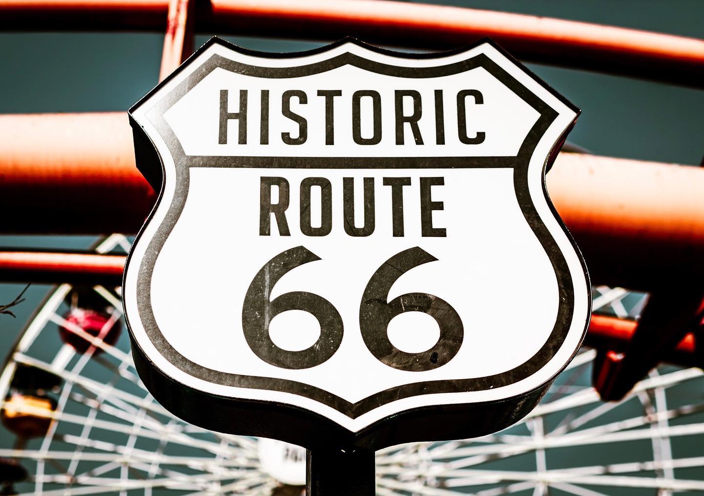
The “Real End” versus the Symbolic End of Route 66: The Santa Monica Pier
Where is the end of Route 66? Technically, the real end is at the intersection of Lincoln and Olympic Ave in Santa Monica, where it meets State Route 1 (The Pacific Coast Highway). However, several organizations, including the Visitors Bureau and Route 66 Alliance, felt that public consensus said otherwise. In 2009, they established a sign on the Santa Monica Pier as the symbolic end to the famous Route 66.
Seeing Changes
With the establishment of the 1956 Interstate Highway Act, Route 66 began to decline in popularity as travelers took to the express lanes. Slowly, new interstates replaced parts of the route until they reached complete replacement in 1984. Route 66 was officially decommissioned in 1985. Parts of the road became business loops, while other sections became nothing more than ignored side roads along the freeway.
Is Route 66 gone? Not entirely. The good news is that you can still drive along many portions of this historic route. There are many associations and local groups working to preserve the remaining portions. About 85 percent remains drivable, in either dirt or paved road condition.
Whether you take the drive from Chicago to Santa Monica, or just a portion of it, stop by Pacific Park to say hello at the end of your Route 66 journey!
Feature image courtesy of @boeknee.